Sample answer by Lifestyle Training Centre
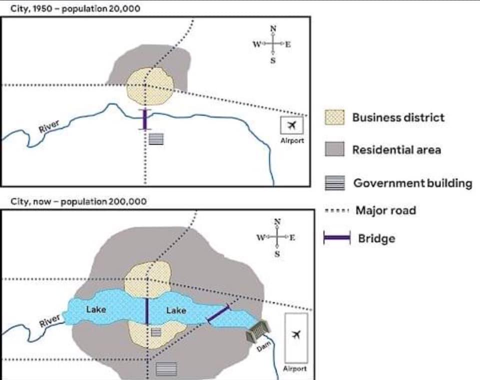
The given map delineates the geographical, population, and infrastructural disparities in a locale between the year 1950 and the present day.
Overall, there is a discernible expansion in the population, residential area, business district, airport, government building, and major roadways between these two timeframes.
The population of the city dramatically augmented from 20,000 in 1950 to 200,000 at present. Moreover, the residential area now covers a substantial portion with the expanded business district in the heart, demarcated by a seizable lake, which originally was a small river. Notably, there is now a dam at the south east corner and a new bridge, complementing the existing one that spans the city from south to north.
Further developments include the addition of a major road, spanning from southwest to southeast and interconnecting existing ones. The airport is now tripled in size, and in addition to the one they had adjacent to the centre bridge, a new government building now stands at the south of the city.
(word count 164)
